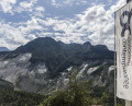
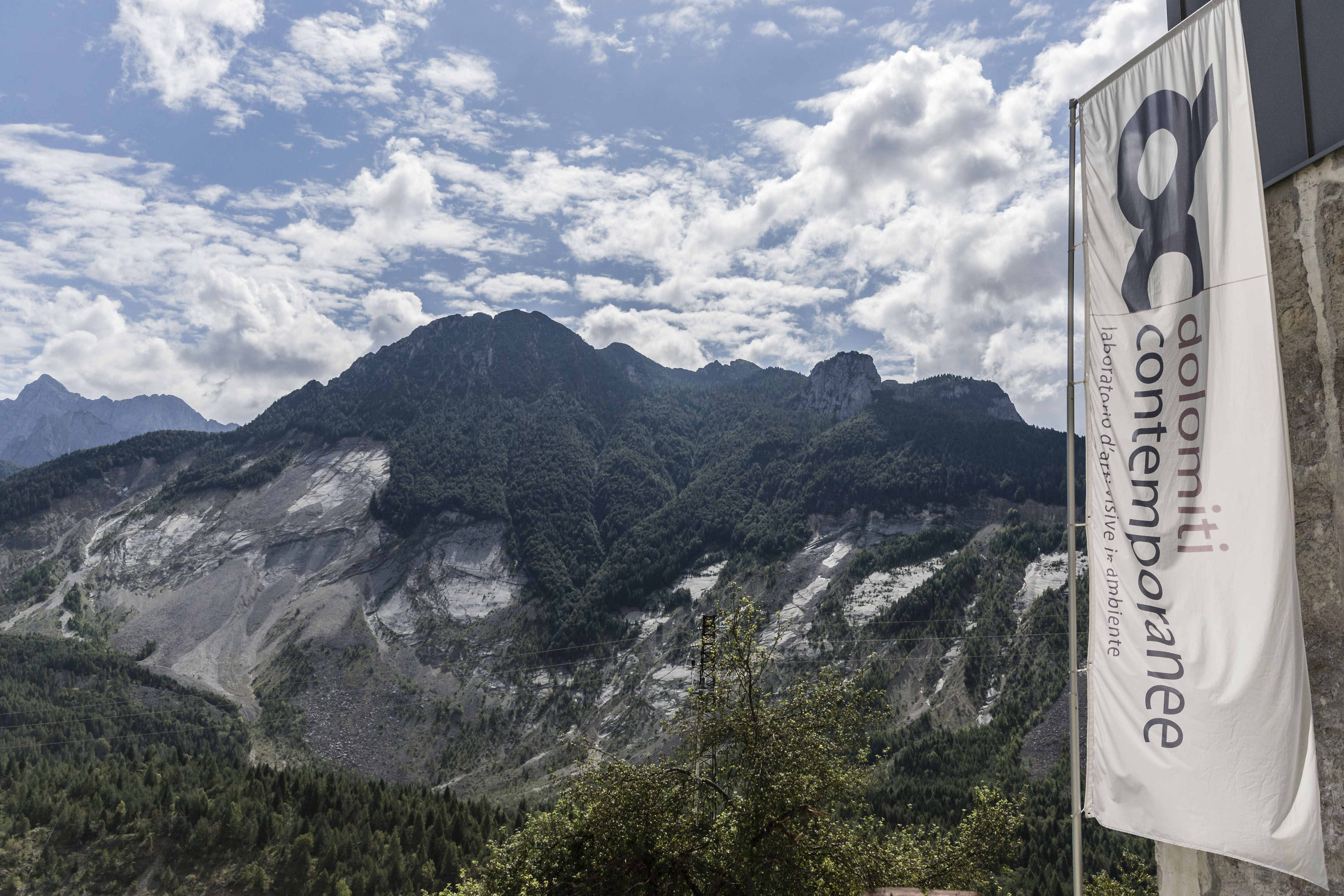
contemporary art contest
concorso internazionale
d'arte contemporanea

GENERAL CONSIDERATIONS
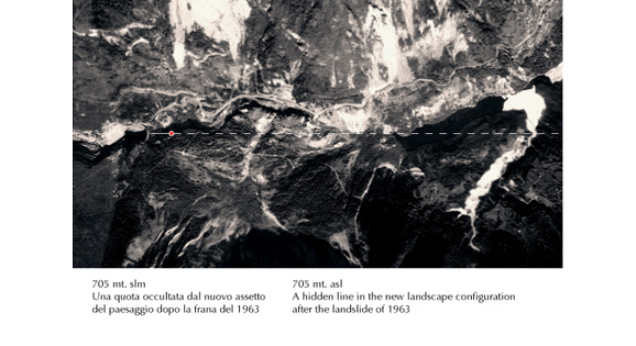
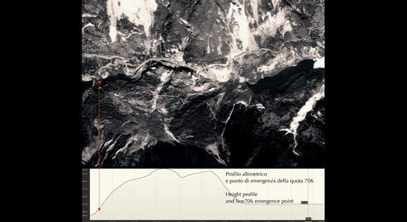
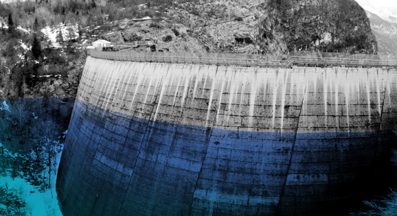
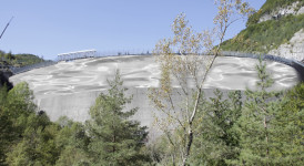
706 mt. asl A line hidden by the changes in landscape after the landslide of 1963
The level 706 mt. a.s.l., the dam fill at the time of disaster, is at present a “ghost line.”
In fact, tracing an imaginary guideline at this level and following the development of the basin to the west and by analyzing the elevation profile, we note that it is also completely deleted by the landslide of the Toc. There is only one intersection point with the existing landscape. A single point of emergency that is localized to about a hundred meters to the west of the dam, on the slopes of the landslide.
THE PROJECT
A generational rejoining in a symbolic book
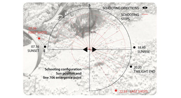
The project consists of creating a symbolic book that tells, with photographic images exclusively, the time passing – the subtle light variations, color and form – at the intersection point of the line 706 with the present landscape, from 7.39, in correspondence with the sun rising, to 22.39, the official tragedy time.
The book will be printed in a limited edition, with a number of copies corresponding to the number of victims of the disaster. Each copy will be titled with the name of every single person who lost his life and will contain the serial number and the photographic images only. No further text. A silent and eloquent sequence at the same time.
With this work we want to bring out a symbolic trace, an imaginary but dramatically real line, that had been buried by the landslide in 1963 and return it to the evidence of the real existence. With this work we want to bring it to a landscape variance, to a tangible materiality, with an action that could be called geographic psychoanalysis.
This operation of revelation is then redelivered to every single person who lost his life in that dramatic night and to those who want to get hold a copy of the book, tracing in this way a passage and a generational rejoining.
THE REALIZATION OF IMAGES
Two static shots and prolonged shooting session for a full day, with the purpose to give voice to a landscape that has lost its actuality at the expense of massive historical memory.
The photographs will be made:
- on October 9, 2015, the same day of the tragedy, 52 years later.
- positioning the chamber at the intersection point of the east-west 706 mt. line and the real landscape.
- This point is estimated at:
46th 16’2.29 “N 12 ° 19’49.14″ And Alt .: 706 mt. asl.
- according to two static shots.
The first in an easterly direction (azimuth 90 ° front of the dam)
The second in a westerly direction (azimuth 270 ° Basin development)
- following sixteen step every hour, from 7.39, at sunrise, until 22:39, the official time of the tragedy.
- Two shots for every step.
- standardizing the exposure time to according image readability and registration of the changes of light color, quality and quantity.
- using flat large format color film (4×5 inch).
–
CONSIDERAZIONI GENERALI
706 mt. slm Una quota occultata dall’assetto del paesaggio dopo la frana del 1963
La quota 706 mt. s.l.m., quota di riempimento della diga al momento del disastro, risulta allo stato attuale una “quota fantasma”.
Tracciando infatti una linea immaginaria che a questo livello segua lo sviluppo del bacino in direzione ovest e analizzando il profilo altimetrico, notiamo che risulta anch’essa completamente cancellata dalla frana del Toc. Esiste un solo punto di intersezione con il paesaggio attuale, un solo punto di emergenza che si localizza a circa un centinaio di metri ad ovest della diga, sulle pendici della frana stessa.
IL PROGETTO
Una ricongiunzione generazionale in un libro a carattere simbolico
Il progetto consiste nella realizzazione di un libro a carattere simbolico che racconti esclusivamente per immagini fotografiche il trascorrere delle ore – le variazioni sottili di luce, colore e forma – in corrispondenza del punto di intersezione della quota 706 con il paesaggio attuale, dalle 7.39, in corrispondenza del sorgere del sole, alle 22.39, ora ufficiale della tragedia.
Il libro verrà stampato in tiratura limitata, con un numero di copie pari al numero di vittime dell’esondazione. Ogni copia sarà titolata con il nome di ogni singola vittima e conterrà esclusivamente il numero progressivo di tiratura e le immagini fotografiche stesse. Nessun testo ulteriore. Una sequenza muta ed eloquente al tempo stesso.
Con quest’operazione si vuole far riaffiorare simbolicamente una traccia, una linea immaginaria ora ma ben reale all’epoca dei fatti. Restituire questa direttrice fantasma all’evidenza reale. Ricondurla ad una varianza del paesaggio, ad una materialità tangibile, con un atto che potremmo definire di psicoanalisi geografica.
Quest’operazione di disvelamento è poi restituita, riconsegnata al tempo stesso ad ogni singola persona che perse la vita in quella drammatica notte e a chi vorrà entrare in possesso di una copia del libro, tracciando in questo modo un passaggio, una ricongiunzione generazionale.
LA REALIZZAZIONE DELLE IMMAGINI
Due inquadrature fisse e una sessione di scatto prolungata per un intero giorno con lo scopo di ridare voce ad un paesaggio che ha perso la sua attualità a discapito di una memoria storica imponente.
Due inquadrature fisse per ridare vita ad un paesaggio, ascoltando quello che ci racconta oggi, come esso sia diverso, cangiante e vitale ad ogni istante.
Le fotografie verranno realizzate:
- il giorno 9 ottobre 2015, lo stesso giorno della tragedia, 52 anni dopo.
- posizionando la camera a bolla nel punto di intersezione tra la direttrice est-ovest 706 mt. slm e il paesaggio reale, punto stimato in:
46°16’2.29”N 12°19’49.14”E Alt.: 706 mt slm.
- secondo due inquadrature fisse.
La prima in direzione est (azimut 90° fronte diga)
La seconda in direzione ovest (azimut 270° sviluppo del bacino)
- seguendo sedici step temporali con cadenza di un’ora, dalle 7.39, in corrispondenza del sorgere del sole, alle 22.39, ora ufficiale della tragedia.
- Due scatti per ogni step.
- parametrando l’esposizione in modo da conciliare leggibilità dell’immagine ed evidenziazione non solo del colore ma anche della direzione, della qualità e della quantità di luce.
- utilizzando pellicola piana colore di grande formato (4×5 inch).
NOTE:
Documentazione storica e tecnica sulla tragedia del Vajont tratta da:
LA GRANDE FRANA DEL VAJONT
Maria Chiara Turrini
Università di Ferrara Corso di Geologia Applicata
Tesi di Laurea
VARIAZIONI MORFOLOGICHE E MODELLO DIGITALE
DELLA GRANDE FRANA DEL VAJONT
Erik Mirini
Università di Udine
Corso di Laurea in Ingegneria dell’Ambiente e delle Risorse
Tesi di Laurea Anno Acc. 2009-2010
Stime di posizione e profili altimetrici
Google Earth


 trieste
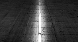
Visions, projects, projections from Vajont
Nuovo Spazio di Casso
[...]

Tuesday, June 15th 2021, 2 – 4 PM, webinar panel:
two calls for vajont: fase _restart.
Vajont: [...]